
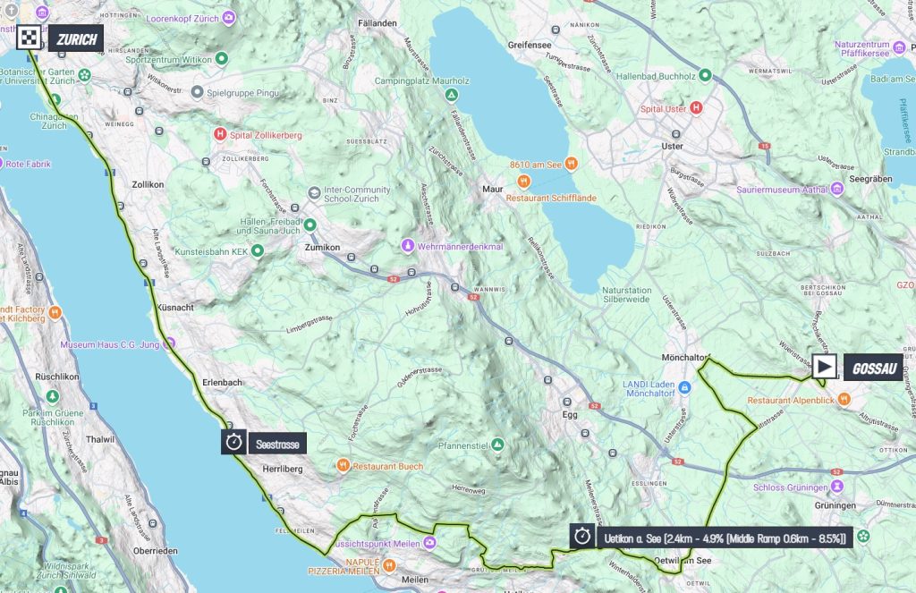
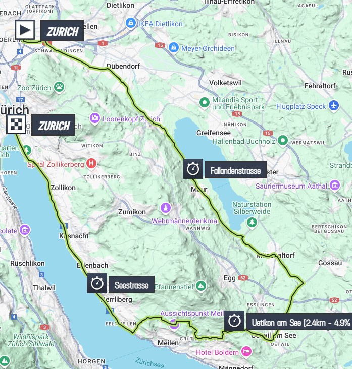
It’s time to race for the rainbow again. This year we do that in Zurich, Switzerland. Together with the Department of Earth and Planetary Sciences at the ETH, the university, in Zurich we look at the geology of the world championships courses. We start with the time trials on Sunday 22 September. We race along the wonderful Lake Zurich and the rolling green hills around the city. To understand how this landscape came to be, we need to start by looking to the south, instead of the city itself.
Slow Alps
On a sunny day, the Swiss Alps form a beautiful panorama that you can enjoy when strolling down the shores of Lake Zürich, where the final of the time trials is. The Swiss Alps are the result of a very long history. This mountain range went from slow divergence to a strike-slip motion and eventually the convergence between Europe and Africa. This process was very slow if you compare it to other mountain ranges. It was so slow that if the Swiss Alps were competing against other mountain ranges in a geological time trial, they would probably be dead last. Lanterne rouge, so to say. To see how the Alps were formed, we travel back in time.
Jurassic start
Our story starts in Jurassic Park, so from around 170 million years ago. It was the time when dinosaurs started to become the dominant land animals but also the time when the supercontinent Pangea on which they lived, started to break apart to form the Atlantic Ocean. In the early stages the Atlantic did not extend north past northwestern Europe. It branched off west through what is now the Pyrenees and the Bay of Biscay to the Alps. This opened up a small tropical sea that geologists refer to as the Alpine Tethys.
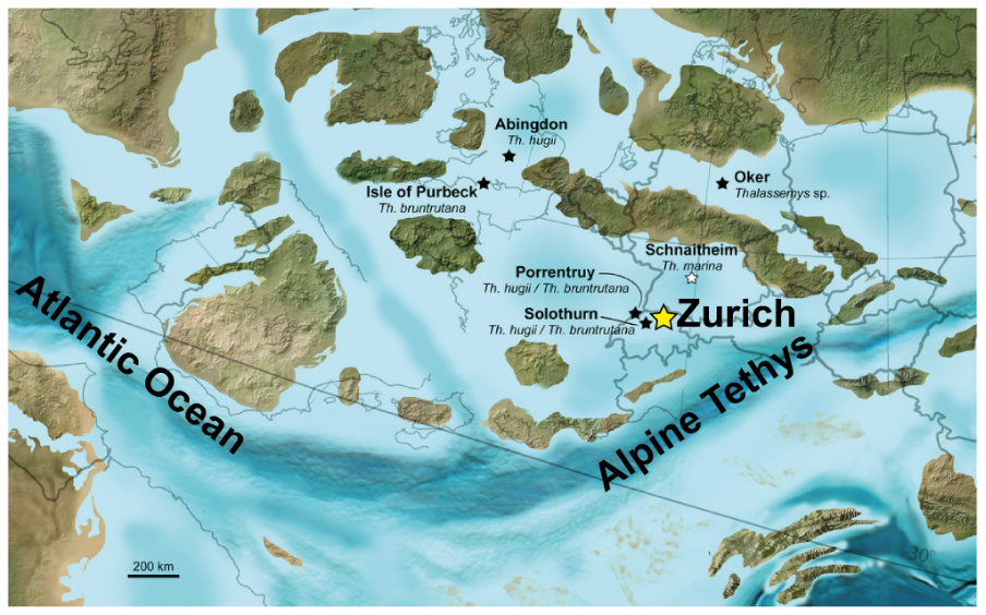
Switzerland was located near the northern margin of this sea. Imagine that it lay at a similar latitude as today’s Red Sea. You would have to bring scuba diving gear instead of skis to any Swiss holiday resort back then. You would sip some cocktails on the beach instead of gluhwein with your cheese fondue. Okay, enough with the stereotypes. During this period, layers of limestones and clays were deposited. Those clays turn out to be quite important later in our story.
Super high mountains
For millions of years, while construction of other famous mountain ranges such as the Himalaya, the Andes and even the neighbouring Dinaric Alps was in full swing, Switzerland remained relatively neutral – geologically speaking. That was about to change. Around 30 million years ago, Africa, or the African plate to be more exact, changed course. It slowly started to bulldoze over what is now Switzerland. The sedimentary rocks that were deposited in the small sea were folded and thrusted up below sea level to start forming the Swiss Alps.
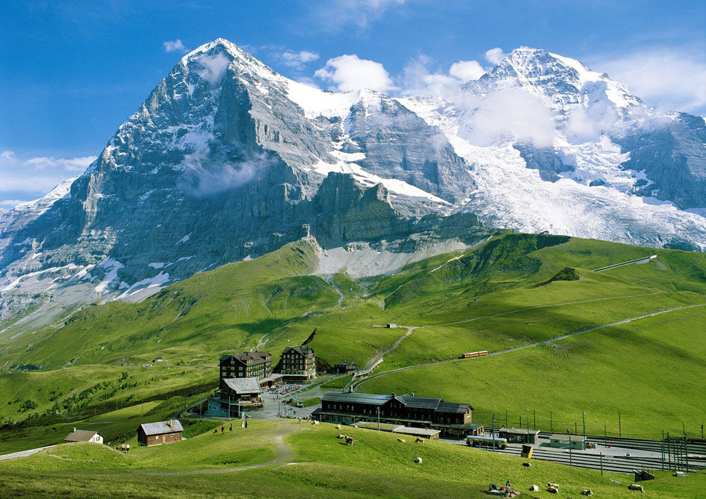
As soon as these rocks came above sea level, the forces of the rain and wind started to break them down. It’s a process we call erosion and it made the Alps a lot lower over time. In fact, even though the Swiss Alps are famous for the snow-capped peaks of mountains like the Mönch, Jungfrau and Matterhorn that stand at more than four kilometers above sea level, these peaks used to be covered by more than ten kilometers of rocks! This did not mean that the Alps used to be 14 km high by the way. There is a lot more to take into account when you determine the elevation of mountains. You can read more in the blog from stage 18 of this year’s men’s Tour de France.
Missing mountain rocks
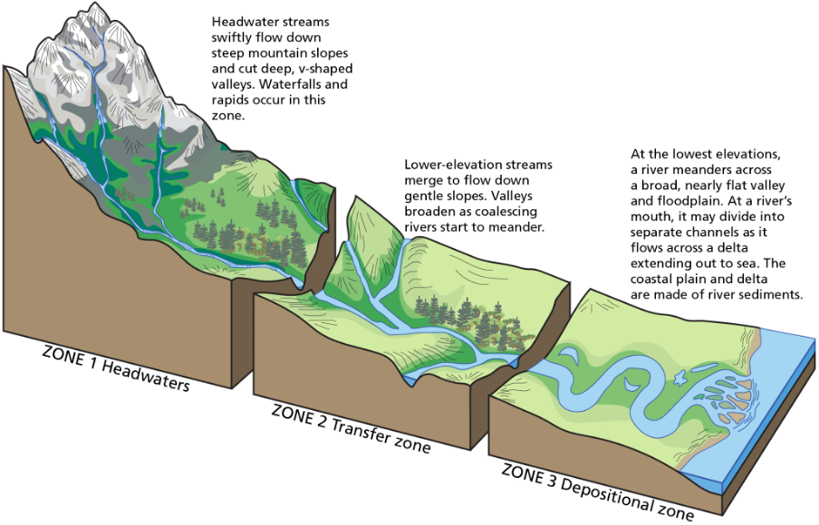
Initially the tops of the Alps were deep below sea level in the Earth’s crust. They were covered by ten kilometers worth of rocks that got scraped off. That means we are missing a lot of rock material. Where did it go? How can so much rock go missing, I hear you think? After years of erosion in Zone 1 of the image below, all the waste products – gravel, sand and mud – were transported northward by river systems. These became the Aare, Reuss, Limmat and, of course, the Rhine rivers.
As these rivers moved northward, much of the larger grains, such as gravel and sand, were deposited more or less horizontally in front of the growing mountain range. This is Zone 2. These deposits form the foundation of Zurich. Meanwhile, the finest grains made their way to north to the North Sea. They built a large delta that we now know as the Netherlands. That is Zone 3 on the image below.
Time to go nuclear
If you compare it to the Alps, Zurich is quite boring. We mean in tectonic terms because this city is never boring. We mean that for a metropolitan area of one million people, not having to deal with disruptive earthquakes is not so bad. In fact, this made the region to the northwest of Zurich the ideal place to build Switzerland’s three nuclear reactors. They collectively supply about 40% of Switzerland’s electricity demand.
As you may know, nuclear energy production yields radioactive material as waste product. This is currently stored in a nearby temporary facility. Temporary, because these facilities at the surface can be used for a few decades at most. Nuclear waste can remain radioactive for up to hundreds of thousands of years. For reference, our human species has only been around for about 300,000 years. There is a problem to solve here.
Geology to the rescue!
Luckily, the Swiss did not have to search for long to find a good place to store their nuclear waste long-term. The best place for it happens to be located deep in the subsurface right beneath the nuclear reactors! Here, we find the Opalinus clay from the start of this blog. It is rock layer made from the mud deposited in Jurassic on the northern edge of the Alpine Tethys tens of millions of years ago. It was then compressed by the weight of all that gravel and sand coming down from the Alps that was deposited on top of it. All that waiting now proves very useful.
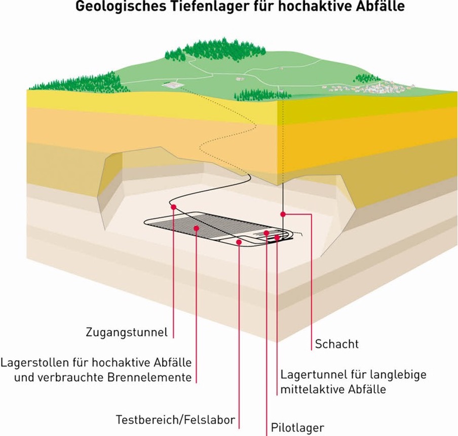
This clay has a characteristic that makes it ideal for nuclear waste storage. It is practically impermeable. This means that any water in the layer will sit still rather than flow through it. In fact, when scientists first drilled through this layer, they encountered the sea water in which the clay was deposited more than 170 million years ago!
One of the reasons for this impermeability, is that the clay is self-sealing. If a crack opens up in the rock and water starts flowing through it, the clay will absorb the water and swell up. This closes the crack again and preventing any further flow of water.
Because of the tectonic stability and the favourable geology of the region around Zurich, the Swiss government is planning to permanently store its nuclear waste in the Opalinus clay. Scientists estimate, based on thorough research and rigorous testing at Nagra, it can safely hold radioactive material for at least a million years. That is more than three times as long as humans have even existed! Stefan Heuberger tells you more about how scientists calculate how it’s safe. He also explains how a tectonically stable place got so hilly.
This blog was auto-translated from English. Any language mistakes are not the author’s.
