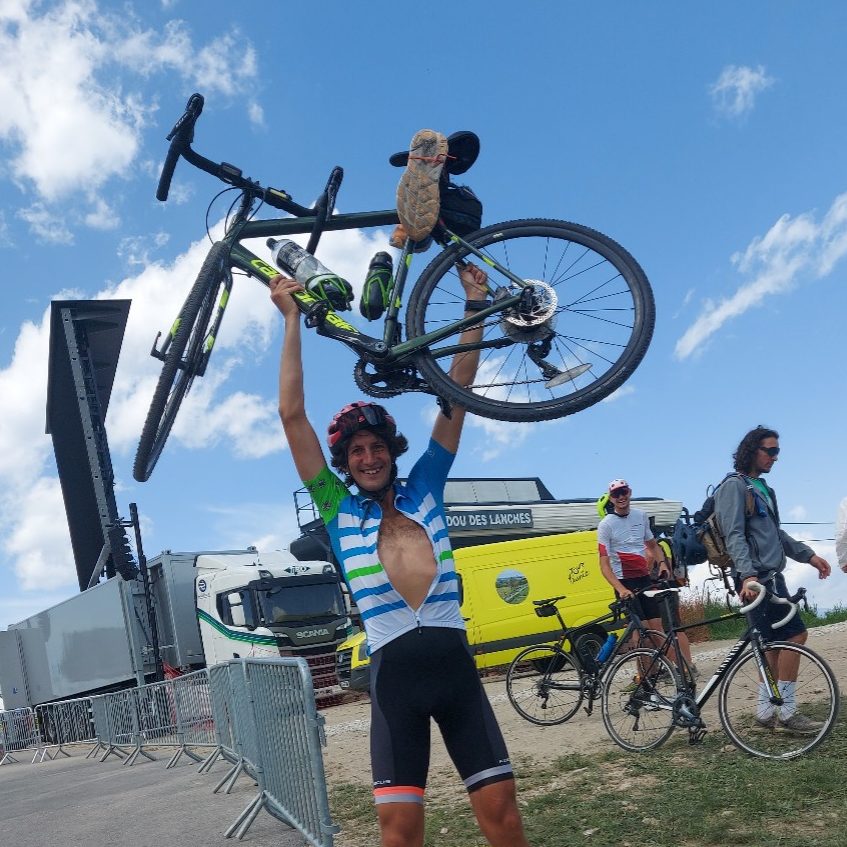
Let’s climb 3700 meters of elevation. Let’s ride 150 kilometers to conclude this Tour de France Femmes. How can we do that better than with the iconic 21 legendary hairpins of Alpe d’Huez. The grand finale of this year’s Tour de France Femmes traverses through the depths of an ancient ocean. It has been uplifted by tectonic forces to form spectacular 3000 meter high peaks. We expect it’s certainly going to be sink or swim for the riders! The ultimate test to decide who will rise to the top in yellow!
Tectonic basics
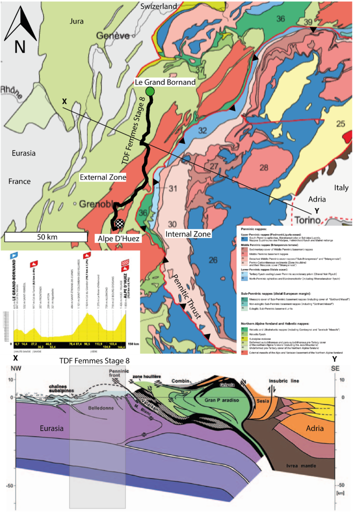
Let’s climb but never without tectonics. Today’s stage has all the ingredients to be a classic. It follows a southwards route through the North West French Alps from Le Grand Bornand to Alpe d’Huez. The Alps formed due to the collision between two continental plates. There was Eurasia to the north and west (France) and Adria to the south and east (Italy). As these two plates collided approximately 40 million years ago, a small ocean basin separating them closed. Eventually the continental margin of Eurasia was buried (subducted) southwards beneath Adria. This can’t come as a surprise anymore after a few years of GeoTDF.
Bulldozing rocks
The starting village of Le Grand Bornand lies at the heart of the Aravis mountains in Haute Savoie. The Aravis chain belongs to external ranges of the Alps and lies on the Eurasian plate. In fact, all of today’s stage stays on the Eurasian Plate. It undulates through shallow marine sediments and crystalline basement that comprised the SW continental margin of Eurasia prior to alpine mountain building.
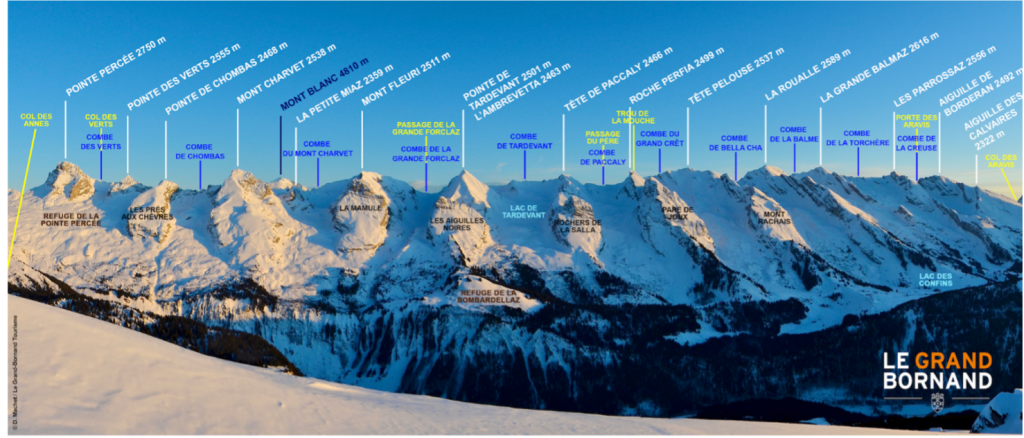
The external ranges limestones and mudstones. They were buried to only shallow depths during the alpine mountain building, before being scraped off and folded and thrusted like a bulldozer ploughing snow, as Eurasia collided with Adria. The Aravis Chain is a N-S trending 25 kilometer long ridge of peaks. The highest is Pointe Percée at 2750m but the mighty Mt Blanc looms over it at 4809m.
Let’s swim
After leaving the Aravis, the route heads south and takes the riders south over the Col du Marlais before descending to the towns of Saint Ferrol and Faverge. It is located in an enormous U-shaped valley, carved out by glaciers during the last ice age. This was approximately 20,000 years ago. The famous and beautiful Lac Annecy which is about ten kilometers to the west of the route and the fourth largest lake in France, is also the result of this process.

The race enters the Massif de Bauges Geopark. The park is famous for its spectacular cliffs formed by folding and thrusting of Jurassic limestones, shales and tertiary sediments. They were laid down in the same shallow sea as the Aravis layers. The race passes through a spectacular upright fold as the sedimentary strata was buckled during alpine compression. It ascends the gentle Col du Tamie (9.5 km at 4%) reaching an elevation of 907 m before descending to Fronteax. There we find more complexly deformed marine sedimentary rocks.
Rumble
The riders get a brief respite as they head along the flat. Then they follow along the Maurienne Valley before they start the monster climb up col du Glandon (19.7 km at 7.2%) reaching 1924m. The rocks within the Maurienne valley belong to the Belledone Massif. This comprises the crystalline basement of the Eurasian continental margin that underlie the Jurassic shallow water limestones and other sedimentary rocks exposed earlier in the Bauges Massif and Aravis Mountains.
The Belledonne Massif was first buried beneath the internal Alpine zones during thrusting on the Penninic frontal thrust (the main plate boundary) about 33 million years ago. Because continental rocks are less dense and therefore more buoyant than the underlying mantle, the subduction zone jammed up. Rocks further west on the Eurasian Plate were affected by strong compressional stress. This led to the exhumation and uplift of the Belledonne massif.

Between August 2017 and March 2019, there was intense micro-seismicity along the Maurienne Valley due to reactivation of a strike-slip fault and minor movements on another fault. Although many of these tremors were not detectable on the surface and were thankfully not strong enough to cause any damage. The strongest only had a magnitude of ~3.5. However, this recent seismicity shows the Alps are still tectonically active and continue to grow due to collision with Africa and Eurasia. This causes the eventual closure of the Mediterranean Sea in tens of millions of years. But for now, we are safe.
Downhill
Upon reaching the summit of the Col du Glandon, the riders face a long fast downhill. They reach the town of Bourg-d’Oisans at the foot of the legendary climb up to the ski resort of Alpe d’Huez. It is famous for 21 mystical hairpin bends and relentlessly tough gradients (13.8 km at 8.1%). As the riders suffer up this punishing final climb, they actually pass through spectacularly folded Jurassic strata. Marjolein Naudé gives us a closer look in this video.
When they reach halfway at hairpin 11 they actually pass by the La Gaurde Thrust. This places structurally deeper crystalline basement rocks above the Jurassic sediments. By the top, they will ironically end up in structurally deeper rock formations than what they started in on the valley floor! We saw that on the men’s stage to the Galibier as well.

In fact, although the stage finishes in skinny air at an altitude of 1850 m above sea level, the local Jurassic rocks at Alpe d’Huez where once buried under several kilometers of sediment at the bottom of a shallow sea approximately 180-140 million years ago. Before the alpine mountain building, steeply dipping normal faults created localised sediment depocenters. These faults where reactivated as thrust faults as the region was squeezed during mountain building.
Let’s climb
If the riders were able to continue by mountain bike or skis further up Alpe d’Huez (and had the energy!), they would also encounter more interesting geology! Alpe d’Huez once boasted a sizable year-round community supported by silver, copper and zinc mining in the Massif des Grandes Rousses. If you closely at today’s Alpe D’Huez ski map, you’ll also find clues as to the location of what was once Europe’s highest coal mine called mine de l’Herpine. It sat at around 2,600m altitude between the pistes of La Sarenne and La Combe Charbonnière.

Anthracite from the Mine de l’Herpie was transported down the mountain to Bourg d’Oisans, first in horse-drawn wagons, and later when production increased via a cable bucket system much like a ski lift. Sadly, production ended abruptly. In 1950 when an avalanche claimed the lives of 12 workers and the mine was forced to cease operations. Today we just enjoy this beautiful place so let’s climb one more time.