
Stage eight brings us to the Burgundy region again. Yesterday on stage 7 we already learned how limestone gives us lovely wines and tomorrow (stage 9) we see how it turns into gravel. Today we build houses and castles with that limestone. We are building history, so to say.
The Burgundy limestones have been in use in the province since, probably, Antiquity. The local limestones are known as ‘Pierre de Bourgogne’. Pierre is French for rock. The ‘Comblanchien’ stone is the most famous. Its name comes from the eponymous city located in the ‘Côte d’Or’ department, just north of Beaune to the east of today’s course. Builders through history used them for many monuments such as the Opéra Garnier in Paris. More recently Pierre de Bourgogne was used for the Louvre Pyramid. Of course this stone can also be found in local construction such as pavements or chimneys in the Hospices de Beaune. Before the Burgundy Canal opened in 1832, the Pierre de Bourgogne was barely used outside of the region for evident logistical reasons. Rocks are just not easy to transport.
Footprint
From an environmental impact point of view, the use of limestones is certainly better than cement-based concrete. The latter has a deep negative carbon footprint. Natural stones are also more durable. Although they mostly provide local or regional needs, Burgundy is so rich in building stone that it can supply remote areas of France as well. The downside is costs. Limestone like Pierre de Bourgogne is typically used regionally due to logistical reasons. Transporting them is very energy-intensive due to their high density.

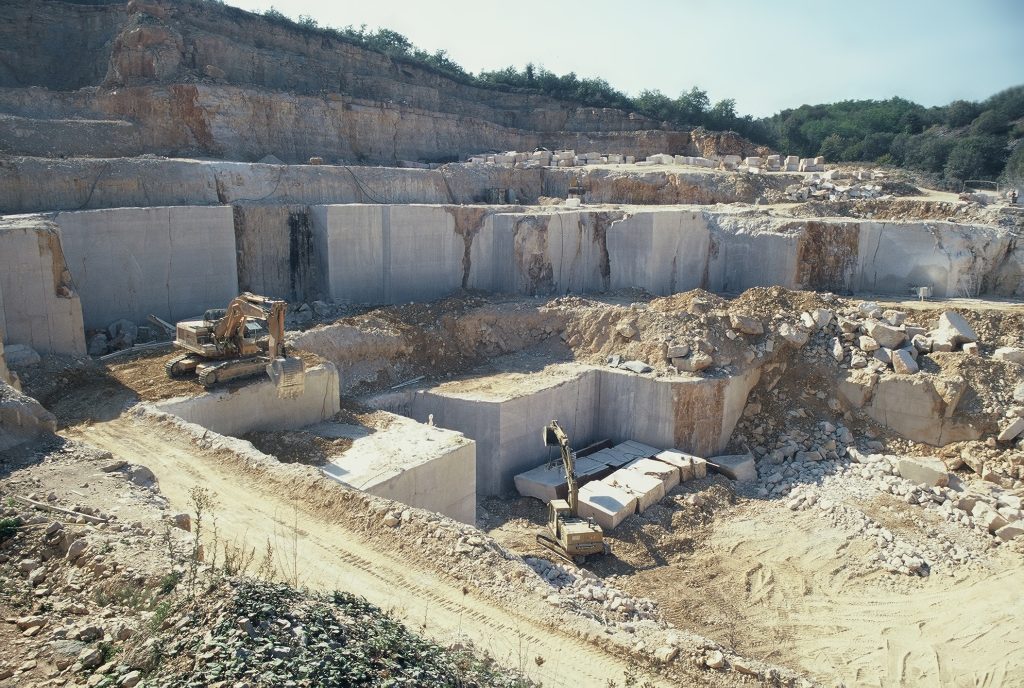
Secondly, extraction also has an environmental impact because most limestone is extracted in open quarries. However, these quarries are typically of small-scale extension. Current regulations require their rehabilitation after closure. We find a notable example in the village of Villars-Fontaine. An ancient quarry has been transformed into a cultural site where graffiti artists are invited to paint the former quarry faces. It’s not building history but creating the future here.
Limestone where?
This year’s Tour de France has a lot of limestone. We ride through the Paris and Aquitaine Basins quite a lot. As you know, France was mostly covered in a tropical sea and all these creatures living there died and eventually turned into limestones.
How can we recognize limestone in nature? A first clue can be found in vegetation. Some plants are termed calcicole species as they thrive better on lime-rich soils. For example, the Pierre de Bourgogne is made of 99% CaCO3, making it the perfect substrate for these plants. However, not everyone is familiar with these calcicole species. The easiest way to recognize limestone is generally through observation. Most of the time, it is light-colored, relatively soft (softer than a knife), and generally white to beige. It reacts when in contact with hydrochloric acid. It also often contains fossils and other traces of former life.
And what about our Pierre de Bourgogne? It dates from the Middle Jurassic, precisely from the Bathonian stage (between 165.3 and 168.2 million years BC). The Pierre de Bourgogne often contains fragments of corals, bivalves (similar to present-day mussels), or echinoderms (similar to present-day sea stars or sea urchins). It also contains millimeter-sized spheres of calcite named oolites.
These small spheres are interpreted to form in shallow, warm waters such as lagoons, due to the accumulation of calcium carbonate (calcite or aragonite) around small particles that are rolled by the movement of the sea. Agglomerated together, they can form a rock locally called the white Oolith in Burgundy.

Long climbs
Don’t worry, the riders don’t face long climbs today but they do on the geological timescale. During today’s stage, the riders will stick to Jurassic in age formations that belongs to the Eastern margin of what we call the Paris sedimentary Basin. The riders will literally climb up the Jurassic stage. They start in the lower Jurassic in Semur-en-Auxois and end in the Upper Jurassic near Colombey-les-Deux-Eglises. This is a climb of 40 million year on the eastern margin of the Paris Basin.
We have discussed the Paris Basin before and dedicate an entire blog to it tomorrow. In short: this sedimentary basin is the largest we can observe in France. It extends from Normandy and Brittany to almost the Rhine graben from West to East, and from north of the Massif Central to the region of Calais. It is actually connected to the London Basin and opened to the North Sea Basin. However, this is only the present day extension, as this sea used to be much larger. Back in the Jurassic, France was mostly a large sea, with only a few islands corresponding to the former mountains formed during the Variscan Orogeny.
Attention: faults!
Just before today’s stage finish, the peloton crosses a major fault and then rides more or less parallel to it. Dont worry, the riders won’t notice and we won’t have flat tires from it either. But geologically it’s an interesting feature. Its name is the Bray-Vittel fault. Today we can notice it because it cut through the sedimentary rocks of the region we are riding through. The displacement along the fault doesn’t look like much. However, this represents only the geologically young reactivation of a fault that lies below the sedimentary rocks. It is inherited from the Variscan mountain building episode that made the supercontinent Pangea.

In that time, the Bray-Vittel Fault formed a subduction zone in which a tectonic plate in the north (including Belgium and the Netherlands) dipped below a plate in the south (including Bretagne, Massif Central). This large scale fault was reactivated during the Jurassic, as a normal fault, in a time when Pangea started breaking up and also big faults started to form in the region of the Alps and the Aquitaine basin north of the Pyrenees. During the Tertiary, and especially during Miocene (23 to 5 million years ago) times, it was reactivated as a strike slip fault with the south moving a little bit to the left relative to the north. That was probably in response to stresses that came from the formation of the Alps.
After crossing only Jurassic ages in sediments, we can state that the cyclists crossed 300 million years of geological history. We went from the assembly of the Variscan belt to the collision of the Western Alps! That is building a bike race on history.
NB: Blogs in other languages than English are all auto-translated. Our writers are not responsible for any language and spelling mistakes.

