
We start our stage in the Ardennes, more specifically Bastogne in Belgium and travel down south into the French Ardennes. What does Bastogne remind you of? Maybe, it reminds you of tasteful speculoos caramel cookies or an important battle in the Second World War and the War Museum located there now. But above all on this cycling mad blog, Bastogne reminds us of the epic Ardennes cycling classic Liège-Bastogne-Liège.
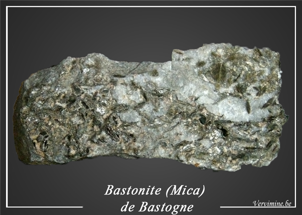
But as geologists we think of the mineral bastonite that was named after the city of Bastogne. For those of you who are interested in everything shiny. It is a mica, a very dark ‘hydro-biotite’, which is found in quartz veins in the Bastogne area. It was first described in the Les Roches Quarry just outside of town in 1862. This is a first for us at GeoTDF, a mineral named after a stage town. We could not not tell you this but in this blog we focus on something else. We are racing up valleys instead of up the hills. Buckle up for some good geological storytelling.
As old as the hills
The Ardennes is the place where the rivers came before the mountains. This is something we will explain shortly because quite often it’s the other way around. In yesterday’s stage we already climbed through the Ardennes over famous climbs like La Redoute and Roche Aux Faucons but we were busy with our Mosasaur. Luckily also on today’s course we find some of the pretty climbs of the Ardennes, although slightly less steep. Let’s travel back in time and see how the rivers came before the mountains in the Ardennes.
“As old as the hills” is a common saying in English, when referring to something of great age. Indirectly it implies that hills and mountains are everlasting. Steadfast, unyielding. The giants of the earth overlook the rise and fall of empires and will continue to do so until the end of time. Geologists disagree. The life cycle of mountains, or rather the rocks that make them, is just an incredibly slow story that spans millions of years. But just like stars, rocks are born and they die. They document the movement of continents, with the history of ancient oceans and long-forgotten volcanoes written within their peaks. That process is what makes geologists tick.
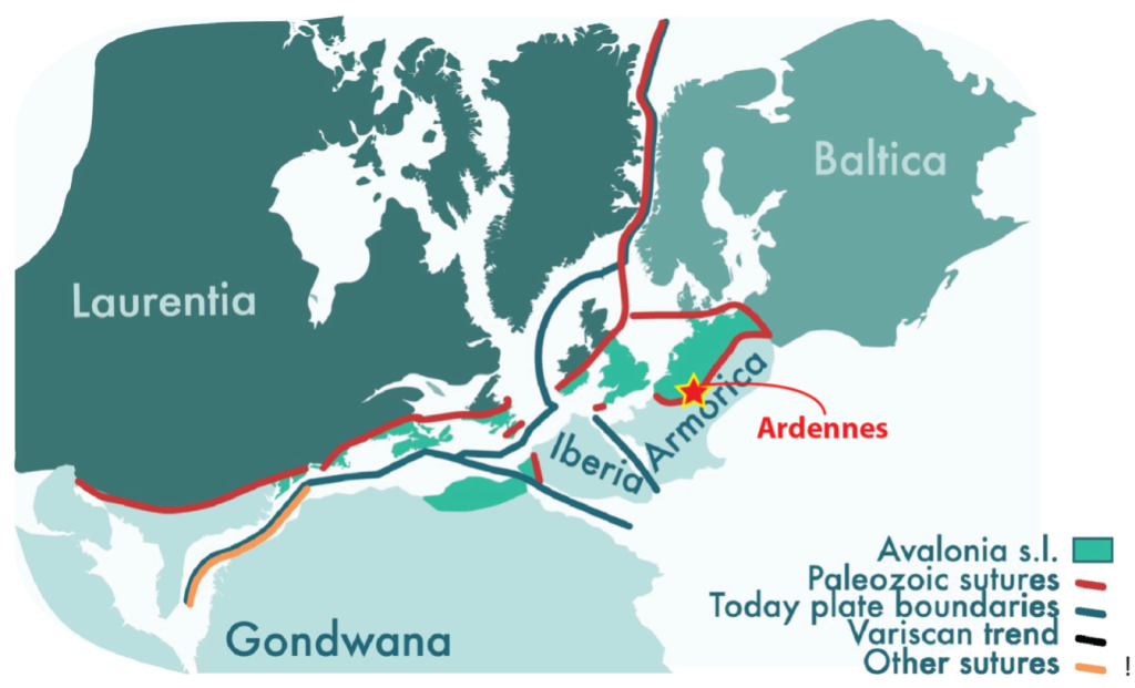
The rocks making up what we now call the Ardennes Mountains formed more than 300 million years ago. They were caught up in a spectacular mountain belt stretching from Poland, through Germany and Belgium, to southern England and the eastern United States. This was before the Atlantic Ocean existed. This mountain belt formed when the continents of Laurasia (North America plus Eurasia) collided with Gondwana (Africa, South America, and all the other southern hemisphere continents) to form the supercontinent Pangea.
The Mighty Mountain
You might think the hills the riders traverse in the Ardennes are remnants of those ancient mountains, but the river Ourthe tells a different story. We are actually racing up the old valleys and not up the hills. Here is where the geology fun of the Ardennes really starts for you.
How do you get mountains? Easy. The land must first rise, forming a ridge or plateau. Then we need some erosive agents to help shape the land. Insert rain or snow. They become brooks, streams and eventually rivers, which cut into the raised land. They always fight their way back to the sea. It’s actually erosion that is responsible for the formation of the beautiful (occasionally snow-capped) peaks that inspired many a poet and amateur holiday photographer.
But the land wants to lay flat. It’s a gross generalization of course; one could argue the land doesn’t actively “want” anything. However, its destiny is to eventually be smoothed out, flat as a pancake. All the hills and mountains that once stood tall, towering over a landscape, will break apart and flatten out. The old mountain ranges of the Carboniferous and Devonian are gone, and in 200 million years or so from now, the Pyrenees and Alps will have gone too. They just need the time to erode. We saw this process around the course of the Olympic Games too where the hills in Paris itself were literrally the last one standing.
Rivers Going Rogue
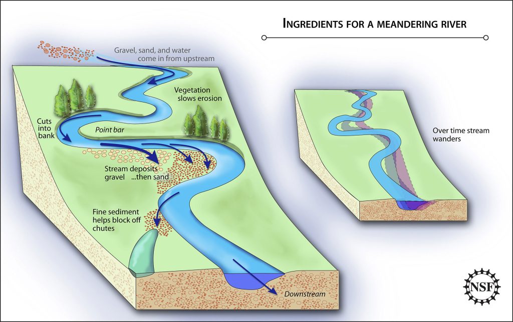
Back to the rivers. Rivers take all the fragments from the mountains they erode and transport them down, down, down. This fills in the hollows and crevasses of our world. Even the mightiest mountain, or man-made structures like pyramids, will eventually erode and disappear leaving a flat surface. Rivers shape the land, but the landscape also has a thing or two to say about how a river flows. The steepness of a slope can influence the kind of path a river takes. In mountainous terrain, they follow gravity to find the fastest way down, cutting straight, sharp valleys.
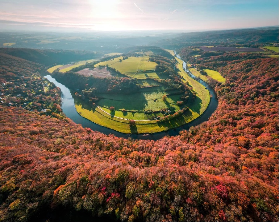
Once they reach flatter ground, rivers curve their way across plains in “meanders” as they take their sweet time to reach the sea. Such meanders are well-known from rivers like the Rhine, the Amazon, or the Mississippi. But rivers like the Ourthe, the Amblève, or the Moselle meander through the Ardennes! You wouldn’t expect that, since rivers don’t usually behave this way in the hills, they only meander in flat areas. One of the most famous locations for this is near the well-known climb of Roche aux Faucons we did yesterday.
But How?
These rivers meander like they would across a plain. And if you climb out of the valleys, you’ll see that the hill tops are flat. You can connect hilltops across multiple valleys with a straight line. This tells us that the River Ourthe and its friends were already flowing through the area, back when the Ardennes were flat. The hills that formed here in Devonian and Carboniferous times are gone, eroded away after tens of millions years of erosion. Ample room for the river to meander across the once mighty mountains.
What happened next is what creates our paradox. The rivers were minding their own business, and then around 1 million years ago the land began to rise all over again. This caused the river to erode into the plains and make the meandering valleys that form the Ardennes as we know them today. By doing so, the rivers created the hills. They dug deeper, creating climbs on what was once a valley. Fascinating isn’t it? We made this clip about it around Liège-Bastogne-Liège.
Always Some Debate
The cause of this (geologically) young mountaineous uplift is a matter of debate among geologists. Some think it has something to do with collisions in the Mediterranean region, but the Ardennes don’t show much deformation in the last million years. They merely rose up. Others speculate volcanism in the Eiffel could be responsible, or even the growing and waning of ice caps in the ice ages. We’ll leave that discussion to them.
So, as a last note, the Ardennes are no longer a mountain belt, but a river belt, where the rivers make the hills! The actual rocks along the parcours were formed and deformed during the birth of an ancient mountain belt. That eroded away. The steep roads that the riders climbed yesterday and will again on stage 5 belong to valleys that formed in a different, much younger time. It’s like an upside down world, geologically speaking. First the rivers, then the climbs. Who will climbs up the valleys the fastest?