
Not only the wheels of our cyclists spin. Even mountains rotate from time to time! That’s exactly what happened to a small piece of the Alpine belt a few million years ago. The so-called Alpine Corsica detached itself from the rest of the Alps. It took a fragment of the European plate with it, thus forming the Corsica Island. The remains of the original connection between the Western Alps and the Corsica Island are preserved in the rocks cropping out in the area between Monaco and Nice, as well as in few places in Corsica. However, we don’t see the remains of the original connection the Ligurian Sea. How and when did the detachment occur? Why don’t we see the underwater Alps anymore? Let’s find out.
Slowly (d)rifting
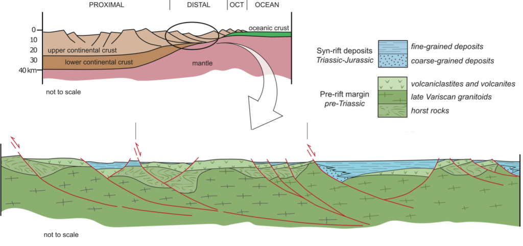
The European plate represents the biggest tectonic plate that composed the northern sector of the Pangea supercontinent during the Paleozoic era (290 million years ago). You could read about this on stage 14. At the beginning of the Mesozoic (250 million years ago), Pangea begins to break up into tectonic plates separated by oceans. The process of oceanization accommodated the drift of the plates that are moving in different directions. This is what we call rifting. It’s the horizontal process of stretching of the continental crust of the drifting plates. The vertical contribution is called spreading and leads to magmas arising from the Earth’s mantle.

The Mesozoic rifting stage produced the stretching of the European continent. The thinned continental crust partially buried under the sea level forming a basin characterized by the deposition of sediments.”These sediments include dolostones and limestones which were deposited above the European margin that sunk below the sea level. Remnants of these sedimentary rocks are located for example along the coast between Monaco and Nice. They constitute the cliffs of the – in cycling famous – Col d’Eze. This domain of the Alpine belt takes the name of Dauphinois in French, Helvetique in Switzerland and Autochthonous in Corsica.
The sedimentation continues for about 150 million years and was associated with the spreading stage. It produced volumes of magma along a narrow ridge, located along the edge where the continental margin reached the minimum thickness. This volcanic activity formed a new oceanic basin called Alpine Tethys.
Short orogeny recap
Repetition is key, even on stage 21, so in short, we go through the Alpine orogeny. In the Upper Cretaceous (about 80 million years ago), the movement of the main plates of the Earth led the convergence of the European and Africa plates. This new geodynamic configuration stopped the spreading stage and started a new tectonic setting able to push the new-formed Alpine Tethys into the mantle, This led to the collision between the continental margins of Europe and Africa. Result: Alps which comes in handy for the Tour de France. The Alps are an orogenic belt made of remains of the Alpine Tethys and fragments of the two continental plates. You find a thick pile of visible, stacked rocks in the Alpine belt on mainland France and on Corsica from Cap Corse to Corte.
Hello, new ocean
The process of collision continued across time, but another tectonic event occurred. That will help us solve the puzzle of the underwater Alps. About 30 million years ago, the scenario abruptly evolved due to the change in movement of the Africa plate. It inverted. We have seen this in the Giro d’Italia too. This change marked the onset of the Apennine Orogeny, leaving the southern portions of the Alpine belt in an extensional tectonic regime. The extension inevitably led to stretching of the crust similar to that occurred in the Mesozoic. That caused the Tethys Ocean. Now the rifting and then the spreading led to a new ocean, named Ligure-Provençal Basin. It’s right off the coast of stage 21.

The opening of the Ligure-Provençal Basin definitely caused the counter-clockwise rotation of the Alpine Corsica and of a flap of the European margin, where we now find Corsica and Sardinia. The rotation of about 30° was probably achieved during the spreading phase of the Ligure-Provençal basin and ended 13 million years ago. Pioneering studies on the rotation of the Corsica-Sardinia block are based on paleomagnetic data (Van der Voo, 1993; Gattacceca, 2001).
So, where are the underwater Alps?
Further details about the Ligure-Provençal Basin are given by the seismic profiles. It is a geophysical method able to represent the tectonic setting at shallow and deep depths. The TGS-NOPEC seismic profile shows the actual configuration of the Ligure-Provençal Basin. There is clear evidence of the rifting stage characterized by the setting of sediments. This seismic profile suggests that the European continent, so the land we ride on, currently lies above a thick layer of sediments deposited during the last 30 million years.

So, if you ask yourself whether the Alps continue underwater between Nice and the Corsica Island, the answer is yes, they do! However they are buried under 2000 meters of sea water and 10 kilometer of sediments! That must be zero points for the polka dot jersey on the underwater Alps for sure.
NB: Blogs in other languages than English are all auto-translated. Our writers are not responsible for any language and spelling mistakes.
